Autel Robotics EVO Max 4T Industrial Drone
Pre-Order


Autel Robotics EVO Max Overview

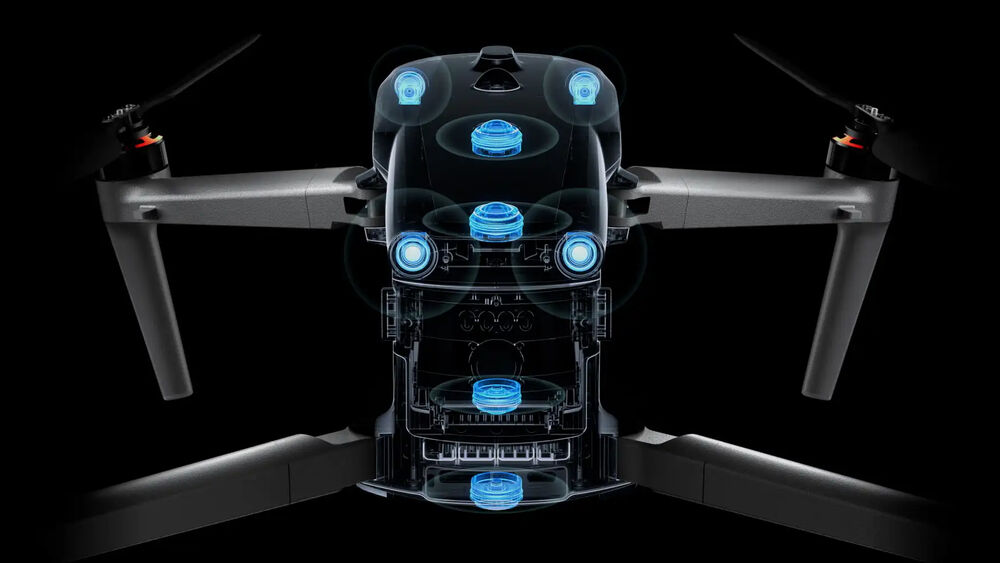
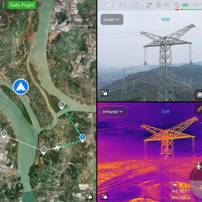
For critical industrial and first responder missions, the EVO Max 4T Industrial Drone from Autel is an ideal tool, providing a robust set of technologies for efficient handling of a wide variety of scenarios. The primary payload offers an 8K zoom, 4K low-light wide-angle, and thermal camera, along with a laser rangefinder. Together they make quick work of inspections, search and rescue, security overwatch, land surveying, and many other operations.
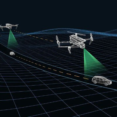
The drone itself can get to locations and perform tasks quickly, even in adverse conditions. Flown by a pilot with the included Smart Controller V3, or allowing the EVO Max 4T to take advantage of a host of advanced navigation and obstacle avoid technologies to fly semi or fully autonomously; alone or together as a fleet or swarm of drones.

Autel Enterprise App
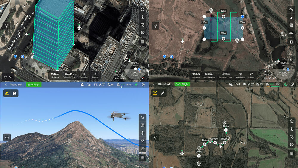
Built for industrial and professional applications, the updated interface provides easy and intuitive operation and offers a host of autonomous and semi-autonomous mission planning functions.
- 3D Map Planning: Plan, create, and execute 3D waypoint mission plans on a 3D map.
- Quick Mission: Temporary quick missions can be created while executing other missions, and multiple sub-missions can be stacked for enhanced flexibility.
- Mission Reproduction: When activated, you can fly a manual or semi-autonomous mission, or string multiple missions together. The drone will automatically record the camera angles and can replicate the mission you flew.
- Polygon Mission: Supports one-click automatic generation of polygon flight areas.
- Terrain Follow: Maintain relatively constant altitude from the ground for uneven or sloped terrain.
- Rectangular Mission: Supports one-click automatic generation of a rectangular flight area.
- Waypoint Mission: Add waypoints for flexible and non-structured flight paths.
- Oblique Photography: Automatically plan 5 groups of routes (1 Ortho and 4 Oblique) according to the flight area set by the user.
- Spiral Mission: Helical flight search in a designed area for SAR.
- Vertical Scan: Perform vertical surveys for building facades, open pit walls, and towers.
- Corridor Mission: Fly missions for roads, rivers, pipelines, power lines, and other narrow, large-scale terrain.
- Automatic Mission Generation & Data Capture: Automatically produce routes by adding regional boundary points through dots or importing KML files.
Data Security
The video, images, and flight logs are all secured with AES-256 data encryption and password protection. In addition, all user and aircraft data, including flight logs, locations, and account information, can only be accessed physically by those with access to the aircraft.
Additional Features
- Designed to deploy to the sky in just 15 seconds
- IP43-rated water and dust resistance
- Up to 42 minutes of flight
- Hot-swappable batteries
- Up to 52 mph flight speed
- Up to 27 mph wind resistance
- Up to 23,000' service ceiling
- Foldable design for easy storage and transport